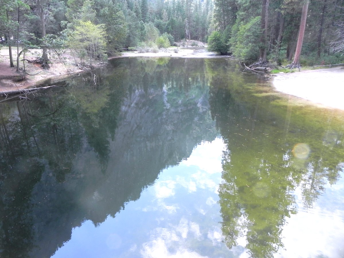
 As we traveled south from Oregon to southern California we chose to spend some time in Yosemite National Park. While not the largest of our national parks, it has some spectacular scenery that is comparable to that of Yellowstone or Glacier. Most years the dry summer causes the water features to fall to a mere trickle, but we were fortunate in our late summer visit, that this year the park experienced a far above normal snowpack and so the streams were still at relatively high flow levels. This made the many waterfalls much more impressive.
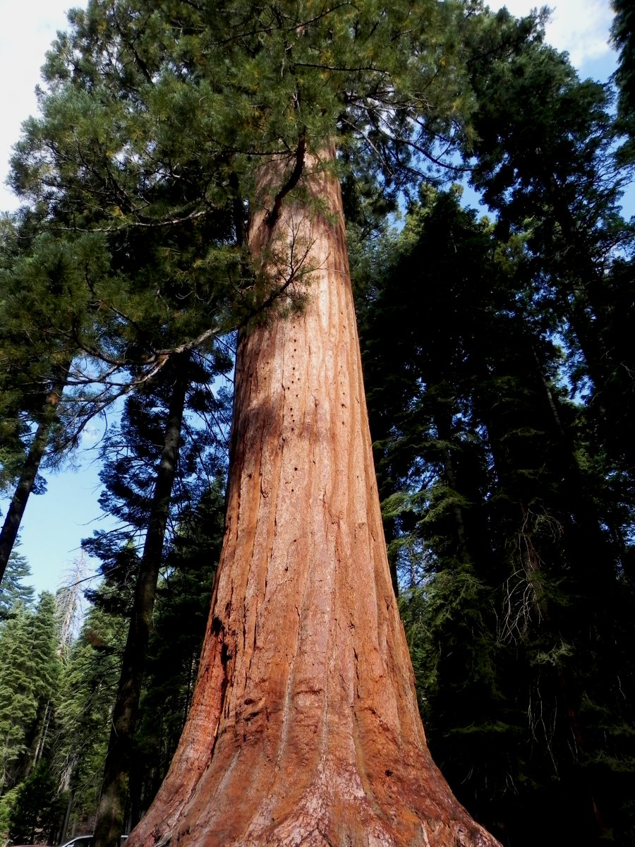
We entered the park via the south entrance. Just inside is the road to  Mariposa Grove, an impressive stand of old growth sequoia trees. It was striking to compare those to the redwoods of the northern California coast which we had seen just days before. Here are the two largest species of North American tree, a relatively short distance apart, but in very different climates.
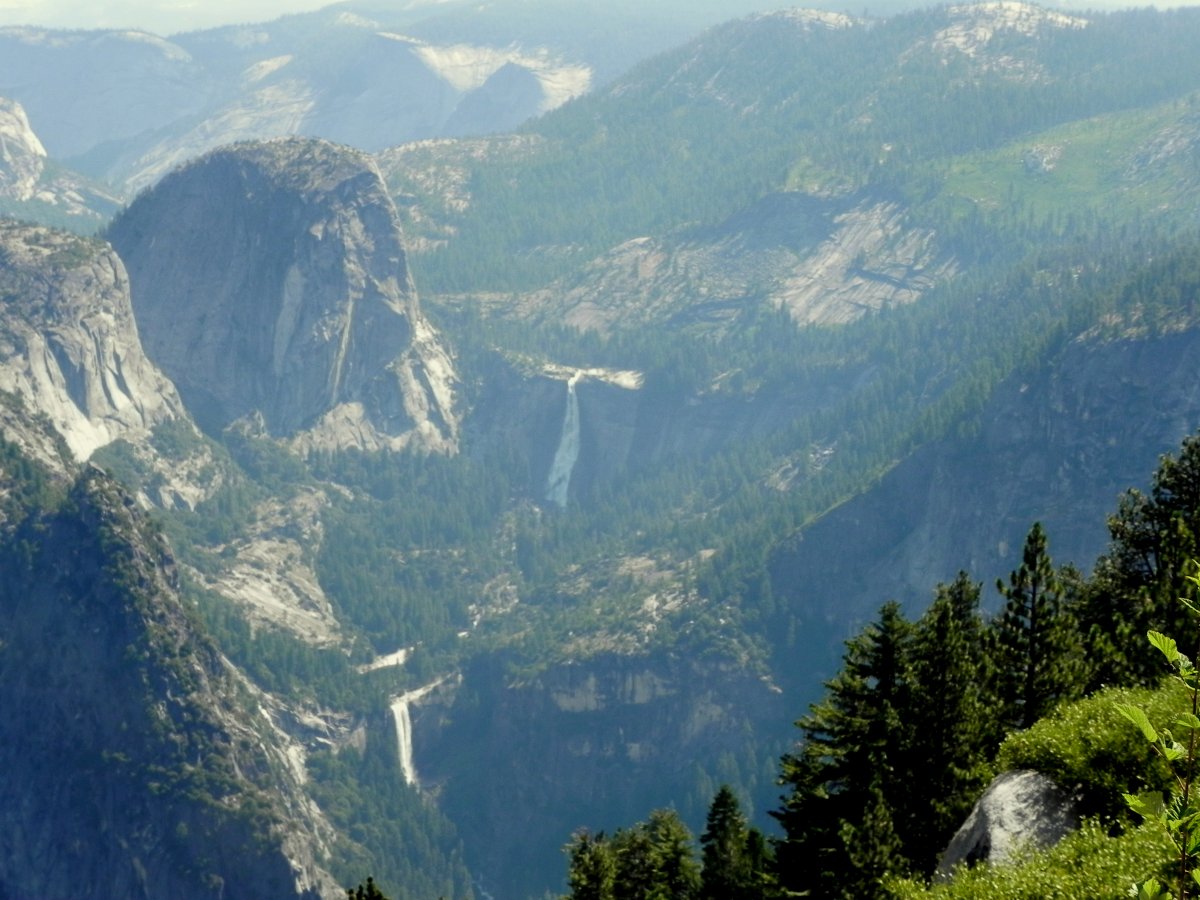
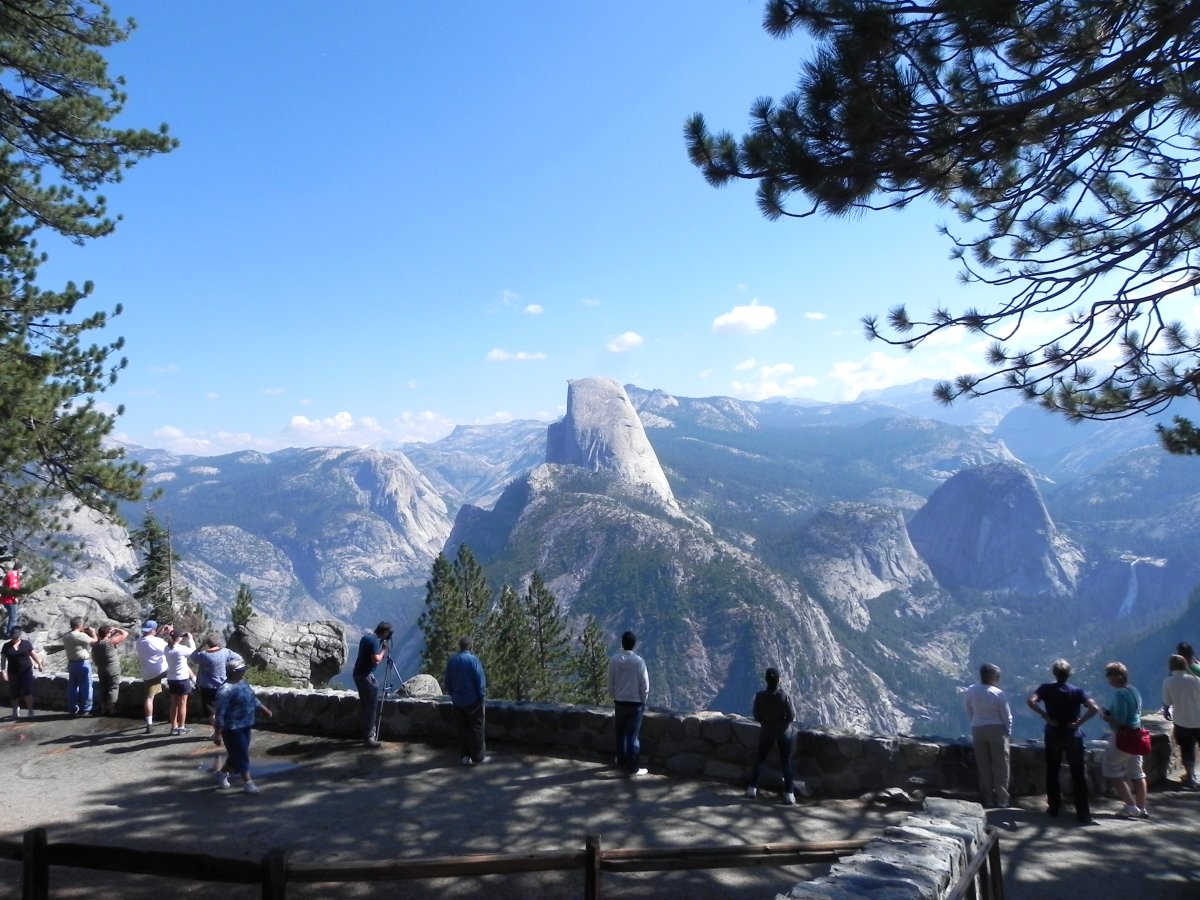
From there we traveled north to Glacier Point road and over that to both Glacier and Washburn Points. Although the two are not far apart they give very different views of the Yosemite Valley, more than 3000 feet below. The trails to the viewpoints are paved and easily walked and Glacier Point also has all visitor services. Along this road are some spectacular views of the bare, rock mountains of Yosemite that are so popular in photographs and 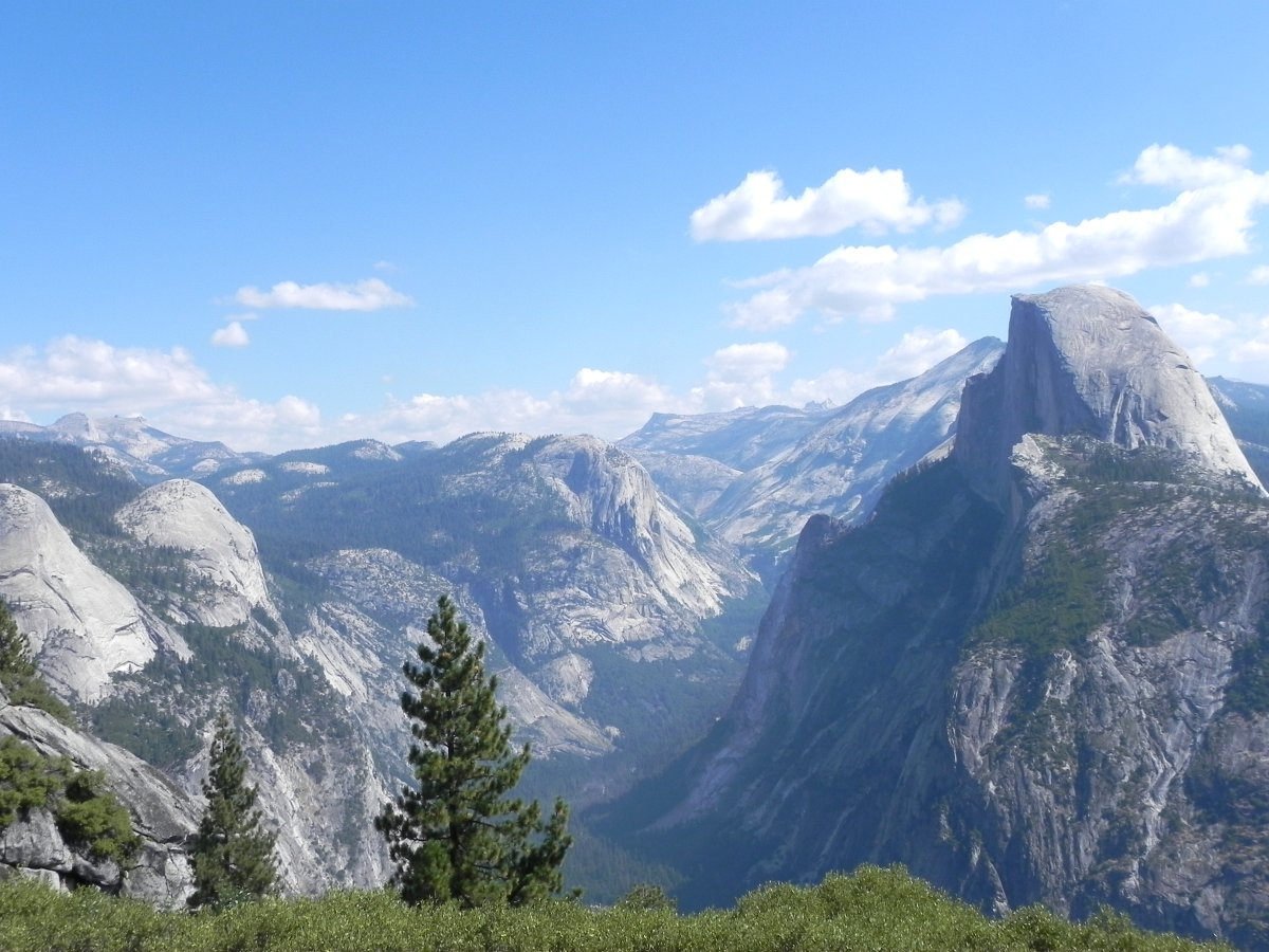 many also with rock climbers. As you travel the road it seems that one approaches sensory overload! Allow plenty of time as you travel, for stops to look and take pictures. Each turn brings a new scene and seems to be more beautiful than the last one.
Our next top was at Bridalveil Falls. After a quick picnic lunch, 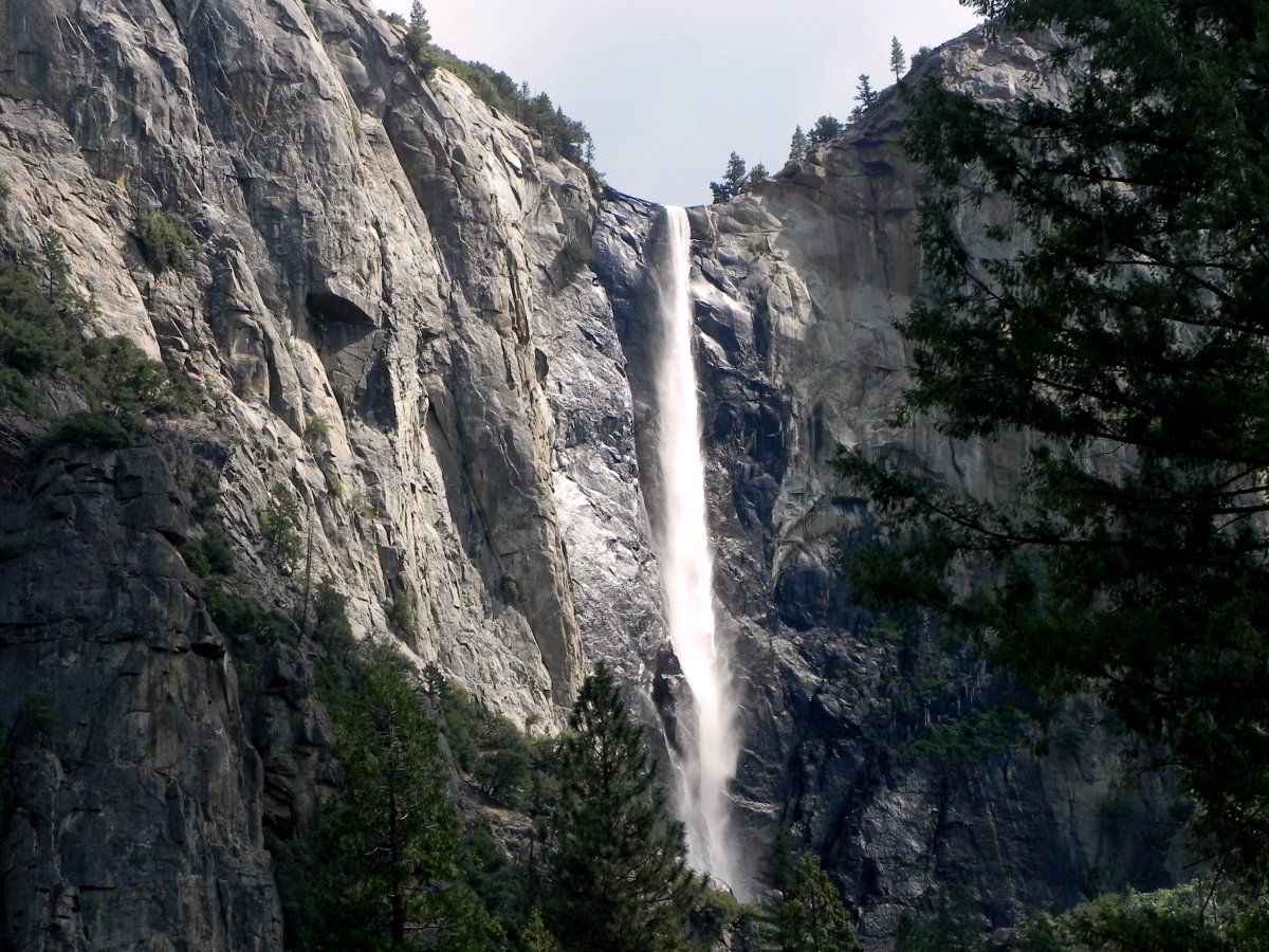 we both made the walk up to the base of the falls. This trail too is paved and easy walking, but a little steep in places. Pam was able to make the trip, but with her ankle brace it made for some difficulty. Even so, she felt that it had been worth the effort. In addition, Pam had not been to the park since she was a small girl and this was my first trip. It does not take long in the park to realize that this is one of those places that every American should see if at all possible.
 For those of us who enjoy taking of photographs, the opportunities are everywhere. If you use a camera with film, be sure that you bring extra and if digital, a large volume of storage is important. The photo opportunities are so numerous that they seen unending.
One thing that we found fascinating is the large 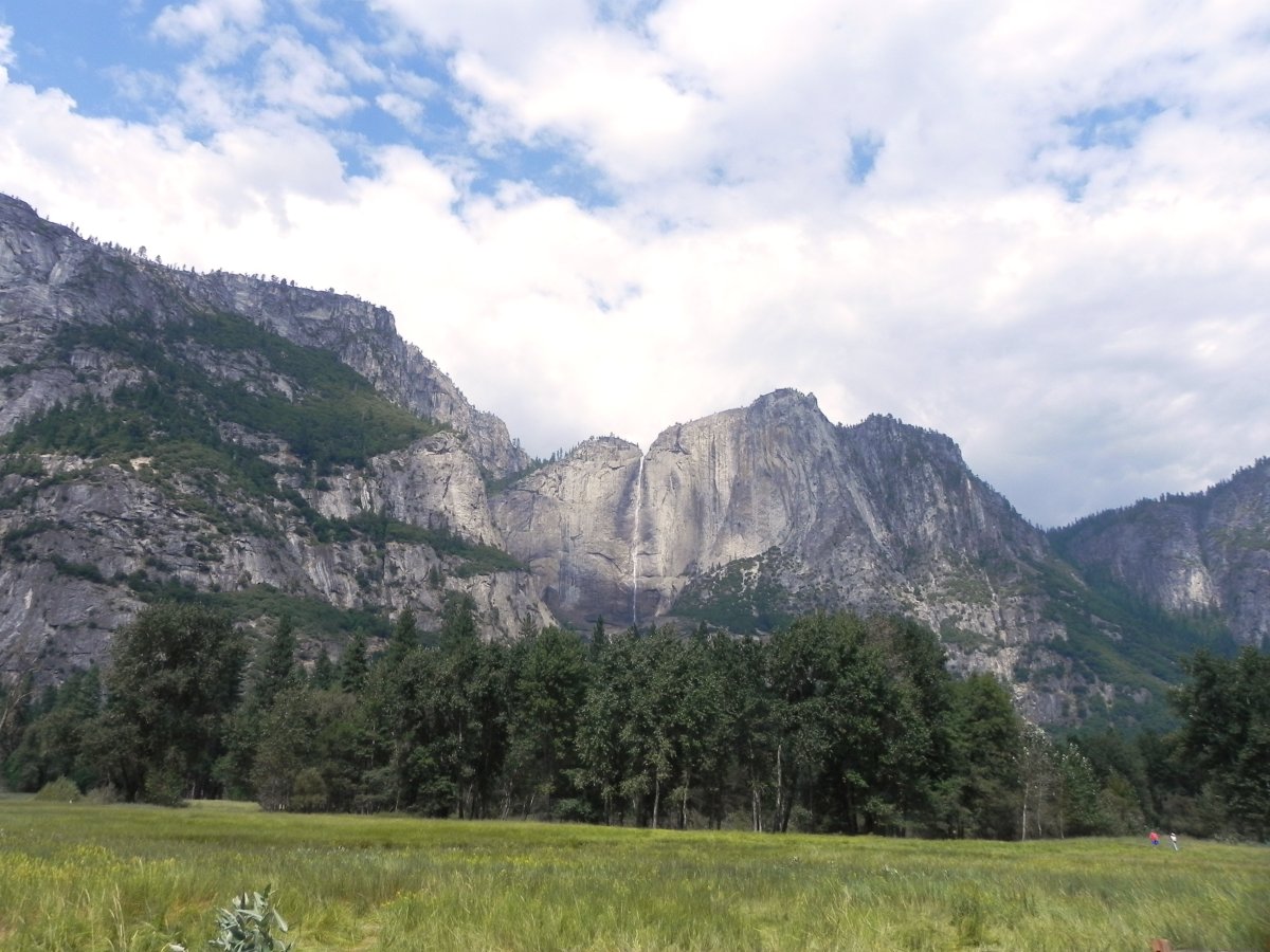 volume of traffic that was in the park, even with our visit well
 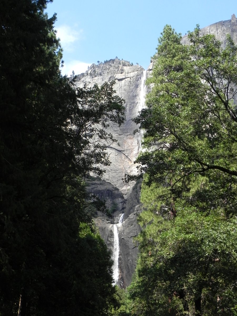 after Labor Day and with schools back in session. If you have the time, nearly all of the park can be seen from free trams that tour the park and which stop at all points of interest. Even with the late time we were here, there were times when parking was difficult to find when visiting the major attractions. If you are retires, as we are, it is wise to time your visit for a time when most schools are in session because of the large visitor volume. In addition, even when we visited, it would have been impossible to have gotten a spot in any of the campgrounds without reservations. If you happen to be a member of Escapees RV Club, the best bet is to put the RV at Park Sierra in Coarsegold and drive in from there. If you wish to stay inside of the park, early reservations are very important, especially if you vist in mid summer. Campsites that have hook-ups for RVs are very limited.
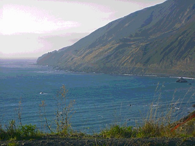
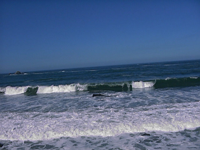
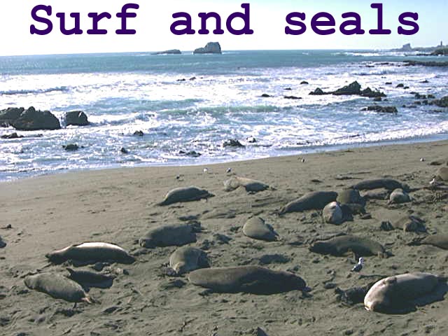
California highway one from Carmel, south to San Simeon is a very scenic road that is worth your time to travel. However, it is very crooked with short steep stretches and extremely short turns. It is not recommended for any but the smallest of RV's. The distance is about 90 miles and the travel time is at least 2 ½ hours, and more if you stop frequently, which is the best way to see the area. Many of the turns require slowing to 35 mph or less. The views are breath taking. Hearst castle at San Simeon is also worth a visit. Allow at least one half day to see it and if you really like grand homes, spend a full day. To visit it, one must buy tour tickets and then ride a bus each way from the visitor's center. There are five different tours of about 45 minutes each. While in the area, take time to stop at Pt. Blanco to see the elephant seals. There is a nice campground at San Simeon St. Park, near both of them.
 |  |
 |  |
 |  |
 |  |
 |  |
 |  |
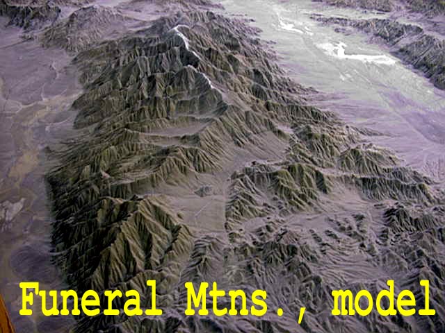
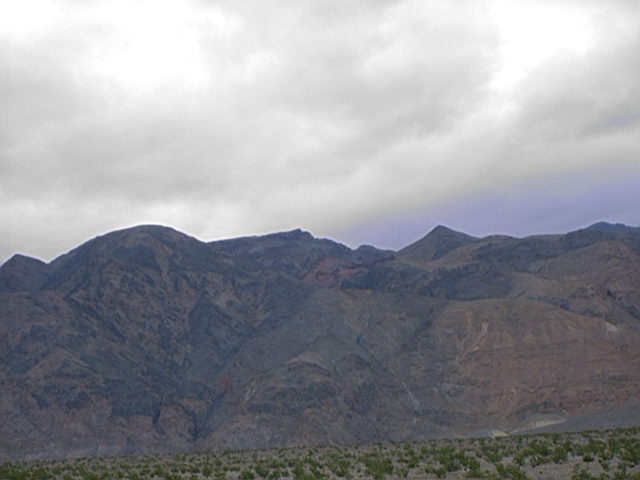
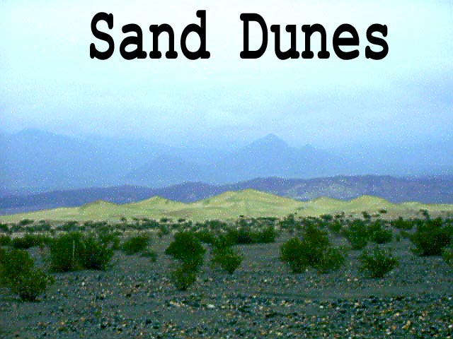
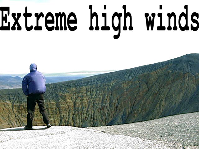
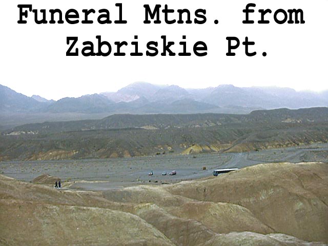
This is, no doubt the harshest environment of any of the National Parks! In summer temperatures frequently rise above 120 degrees and sometimes exceed 130. Yet in the winter there is frequently snow on the mountains, and night temperatures fall near the freezing mark. Average temperatures range from an average high in July of 116.2 and an average low of 39.3 in January.
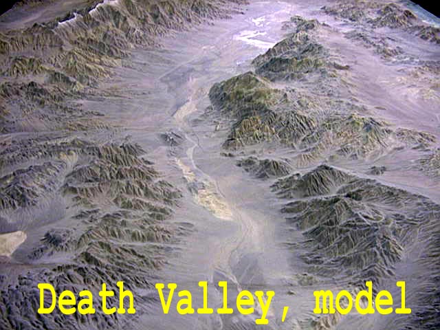
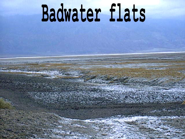
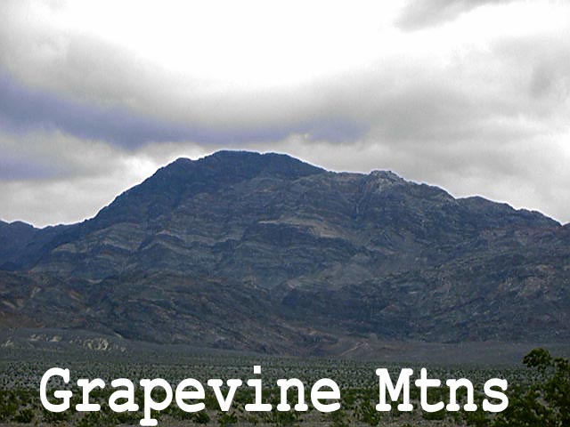
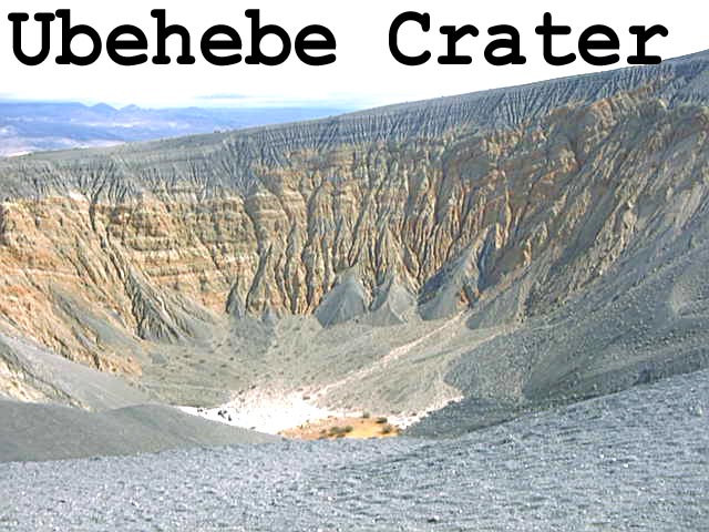
The altitude of the park ranges from 11049 ft. at Telescope Peak, in the Panamint Mountains., to a minus 280 ft. at Badwater. These mountains are some of the most rugged in the country. And the valley floor is slowly dropping lower and lower. The size of the park is 3,336,000 acres.
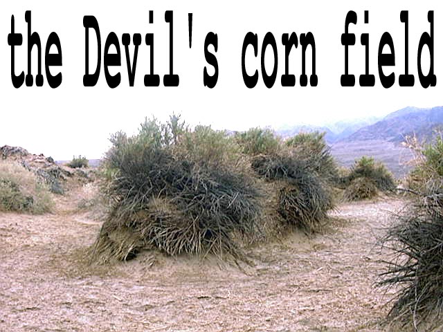
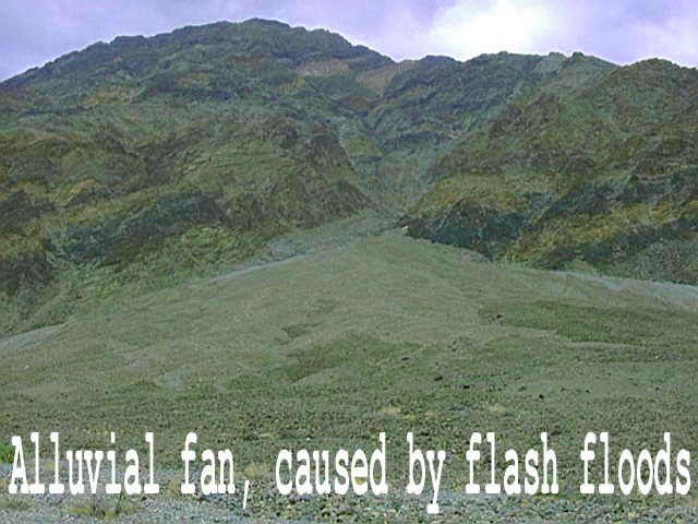
Rain is very rare, but there are a few springs that provide striking areas of green vegetation. When rain falls in the mountains it is usually in the form of a cloud burst, and it causes wild flash floods, but little else.

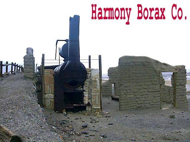
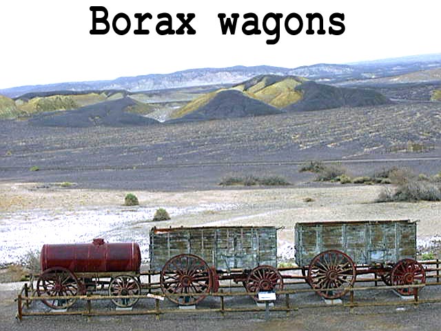
Since there is no outlet from the valley, the small lakes that form after it rains are dead, and some are not safe to drink. The water causes the minerals to leach out as the water evaporates on the valley floor. That is the reason that borax mining has been the most successful mineral ever mined here.
There are three RV camping areas in the valley. Furnace Creek has both a Natl. Park service camp with no hook-ups, and there is also a commercial campground with full hook-ups and rental rooms at Furnace Creek Ranch. The park visitor center is also there.
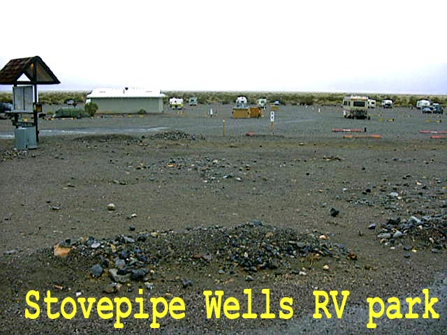
Stovepipe Wells also has a campground with hook-ups, but it is very stark.
Death Valley is an interesting place to visit, so allow yourself at least two days if you wish to see it all. Three days would probably be ample for most visitors to see all of the major attractions and also Scotty’s Castle. If desert hiking or off road exploring are of interest to you, you could well spend months there.


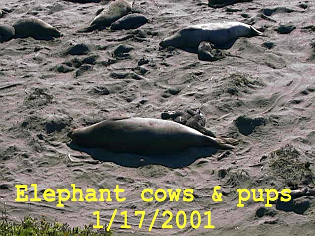
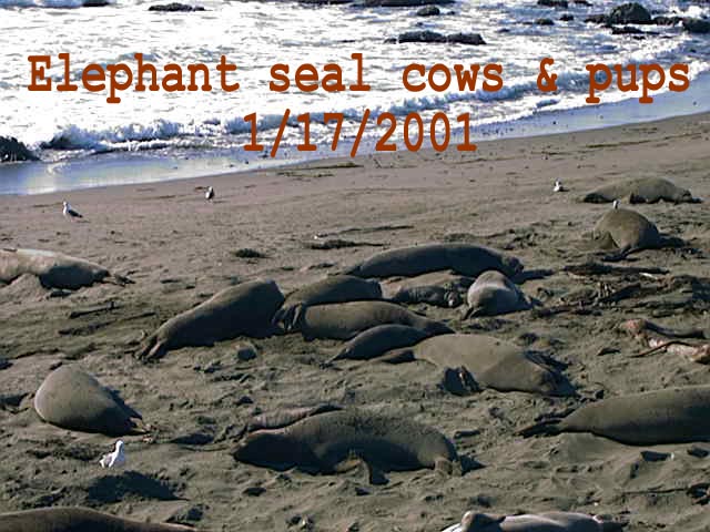
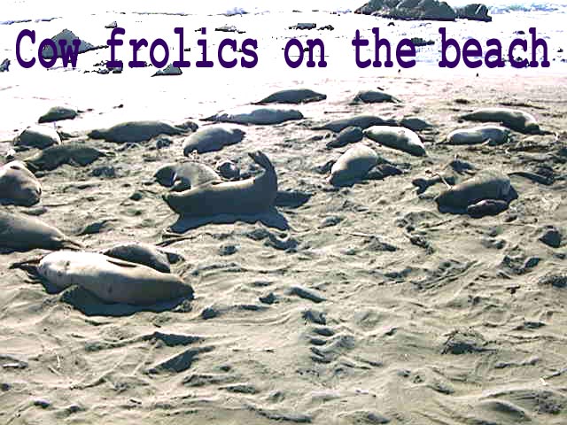
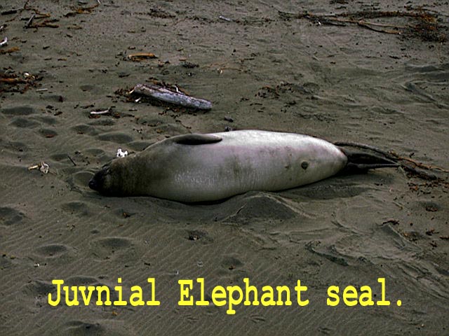
Here are some pictures that I took while visiting a colony of elephant seals near Pt. Blanco, just a few miles north of San Simeon, Ca. The elephant seal is the most unique member of the pedipod family. Other members are the Sea Lion, the Harbor Seal and the Walrus.
Elephant seals are migratory animals and while they congregate in large groups for short periods, they spend months at sea, traveling alone. The life cycle begins with the birth process, which is probably the most interesting part. It starts with the return to the beach of the adult males. They have been far at sea for months, diving to depths as great as 5000 feet to find food and returning to the surface to breath. During the time at sea the adult elephant seal does not return to land at all.
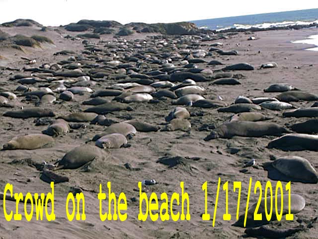
The return begins with the arrival of the smaller males in late November, and the other males follow, with each wave of arrivals larger than the one before until the largest males, weighing as much as 5000 pounds, come ashore. As the larger males arrive, they chase the smaller males to less desirable parts of the beach.

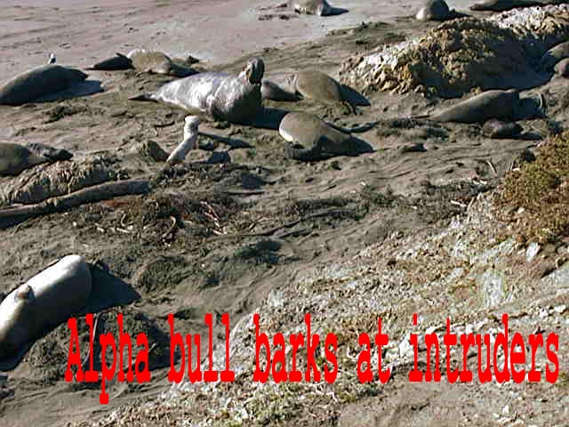
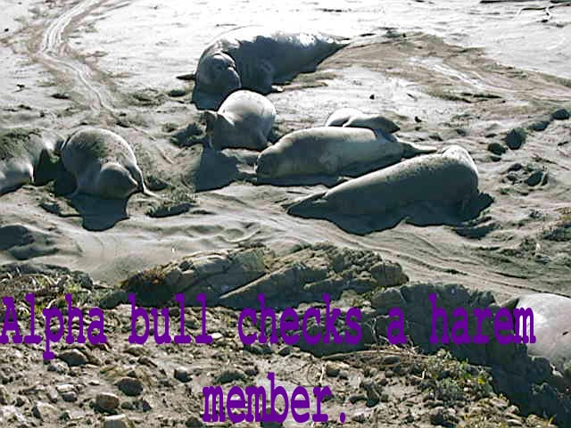
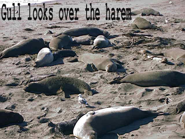
In mid December the pregnant females, weighing between 2000 and 3000 pounds begin arriving. They move into the area of one of the larger males, called alpha males, for protection. In so doing they become a part of his harem in return for his protection. As the number of mothers to be grows, a number of the larger males, not yet large enough to be an alpha, but larger than most, join the edge of the group. They help the alpha to defend his territory from the smaller intruders, in return for his tolerance of their presence. Scientists believe that this alliance is to allow the beta males to get a chance to breed when the opportunity arises and the alpha is busy with other members of the harem who are fertile. This is a very precarious alliance with periodic fighting. If a larger alpha should arrive on the scene, or a more aggressive one, the alphas will at time stage very bloody fights, although we didn't see any.

The female stays to nurse her pup for about one month. During this time neither the males nor the females ever enter the water. The pups weigh from 60 to 100 pounds at birth and they gain an average of 12 pounds per day during the one month that they are nursed, usually weighing between 300 and 500 pounds when the mother leaves to return to sea, alone. Just prior to leaving she will accept the attentions of a male, usually the alpha. The fetus lies dormant for the first two months while the now slender female regains her strength and weight. She will have lost 40% to 50% of her weight. The milk she produces is the highest butterfat content milk known to man.
When the female leaves, she leaves a practically helpless pup on the beach. At this point, the pup does not know how to swim or to eat. It will survive off of the fat it gained in the first month of life for a month or more while it learns to swim and discovers how to eat and hunt. The pups pretty much stay on the beach, making short trips to sea to eat for their first year of life. At some point they begin to venture farther to sea and for longer periods, eventually joining the cycle of adulthood.
The males stay on the beach, fasting, fighting, and breeding for about three months, until early March when all of the female adults have gone. By that time they have lost 50% to 60% of the weight that they arrived with. They now head back to sea to feed until it is time to return to shore to molt in August. At that time elephant seals return to the beach of their birth, as they do to mate.
Females live an average of 20 years and the males about 15 years. It is believed that the difference comes mostly from the fact that the males go out farther and deeper, and thus take greater risks. They also have a much wider weight swing, also thought to be a factor.
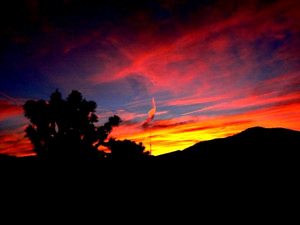
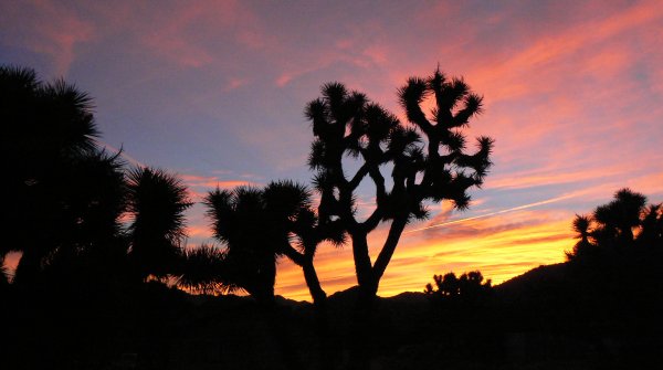
Here we are at Joshua Tree National Park!

On Tuesday, October 2, we moved from Yucaipa Regional Park to our host site in Black Rock Canyon Campground at Joshua Tree National Park. We stayed at this location through Jan. 8, 2008 when it was time to leave for our next volunteer location. We were met by Ranger Cynthia Fero, the ranger in charge of this campground. We found her to be a great person to work with and a good friend.
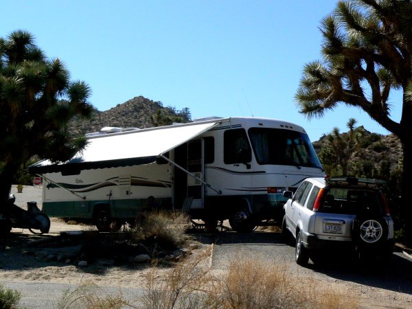

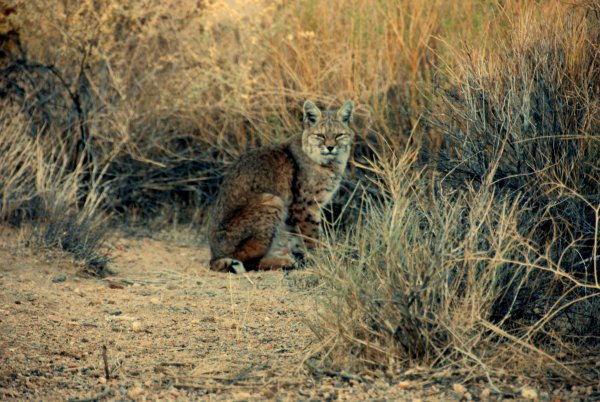
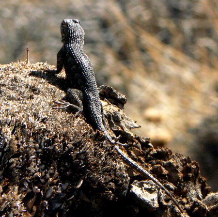
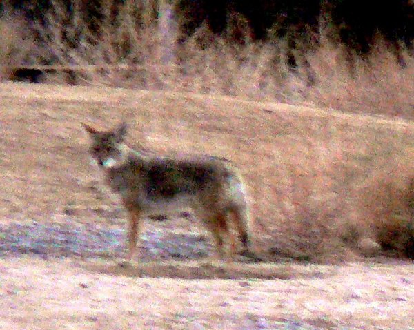
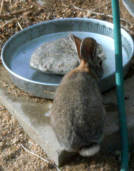
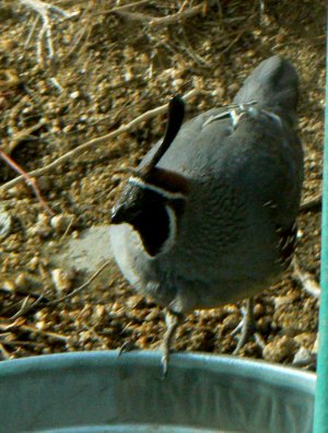
There are two host sites here in the campground and they are the only sites with hook-ups. We had complete utilities with both 30A and 50A power. The area receives no TV from the antenna, but cell phone coverage is very good. We of course had our dish set up and so received both internet and TV from it. I am not sure if there is internet access in the ranger station that a volunteer could use, but they do have internet so I suspect that you could. The area is as quiet as anywhere we have been with a great deal of wildlife in the area. The campground has 99 primitive camp sites and there are water hydrants to fill tanks from and a dump station for camper's use. Many mornings a coyote walked past our site, no more than 50 feet from the motorhome. In fact, wildlife was frequently observed from our site. Muffie was really unhappy about that since none were friendly!
Our main job was to just be in the park during the busy times, mostly week ends and holidays. We were off duty on Christmas and could have left for Thanksgiving but chose to stay and help the duty ranger and to relieve her so that she could join her family for dinner. We also did some litter patrol and occasionally dealt with some camper's problem. In return we were encouraged to participate in all activities in the park and to see everything that is there. It was a very enjoyable three months and the passed very quickly.
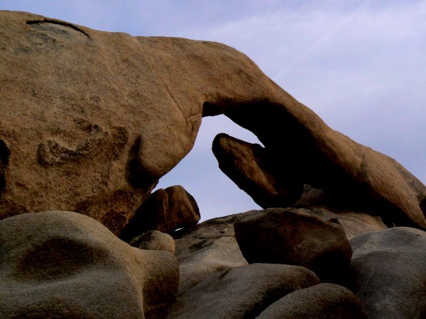

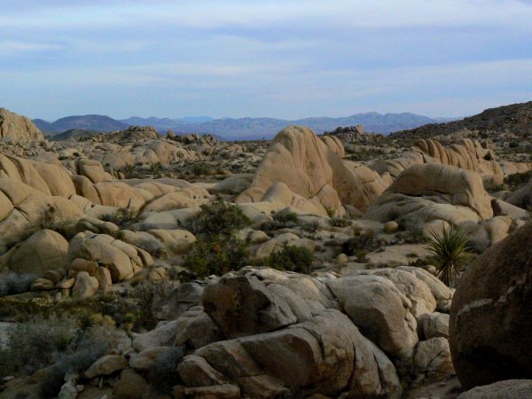
One of the most common activities in the park is hiking with many trails of lengths from less than one mile to as long as thirty three miles. We hiked nearly all of the trails that were under five miles in length. There are also several very interesting historic sites to visit.
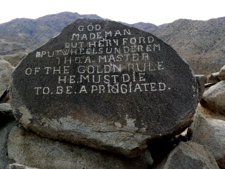
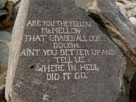
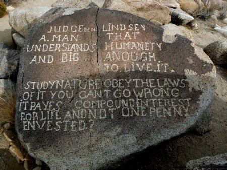
One of the most interesting and unique locations in the park is one called Samuelson's Rocks. He was one of the many strange and unique people who lived for a time out on the Mojave Desert and survived. There is a very interesting story about the man who made these works.
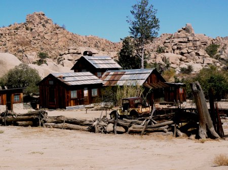


The Keys Ranch is open only by guided tour and is behind a locked gate. It is a wonderful tour with a great deal of history. We were fortunate to have been here while Willis Keys, the oldest living child of rancher Keys, was here as a volunteer caretaker for the ranch. We got to spend an afternoon at the ranch visiting with he and his wife who also grew up in this area in the 20's and 30's. The 49 Palms Oasis is a three mile hike that is to the difficult side but which is well worth the trip. The oasis is a tropical area of an acre or so, far out on the desert where the water that wells up and is the only water there most of the time.
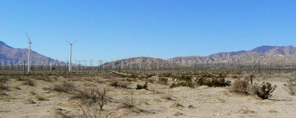

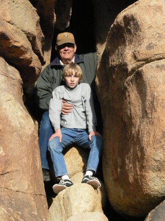
While here we visited many other interesting places and toured the wind farm near Palm Springs, rode the aerial tram from Palm Springs to the top of Mt. San Jancinto, took our grandson who spent ten days with us, rock climbing and we got to meet friend Rudi from the Escapees RV forums.
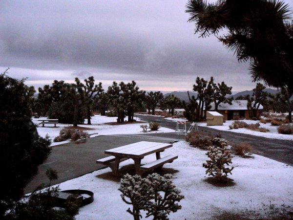
The campground is located at 4000 feet above sea level so it can get quite cold at night in winter and we did get snow just before Christmas. The snow did not last but a day and it was actually quite pretty. But warm clothing is required. Were were supplied uniforms and also both a uniform jacket and winter coat.
We truly enjoyed our time with Joshua Tree NP and will long remember it as one of our special locations. The staff were wonderful to work with and they make a real effort to make each volunteer feel welcome and appreciated. We were treated as equals by the rangers and two of the law enforcement rangers even gave us their home phone numbers & personal cell numbers. That same was true for both the volunteer coordinator and for our direct supervising ranger. They were as great a group to spend time with as one could ever ask for.
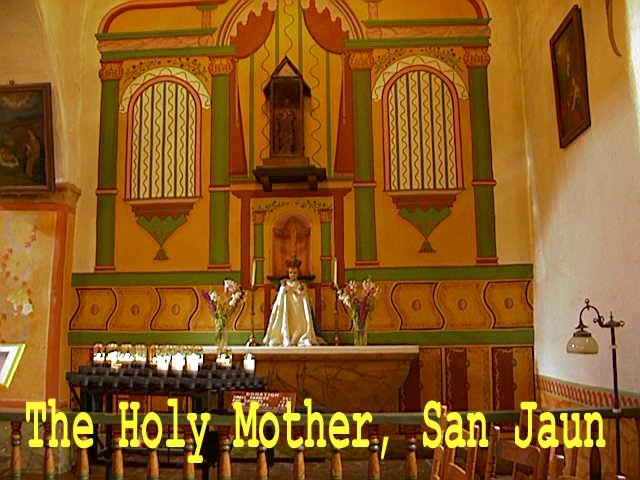
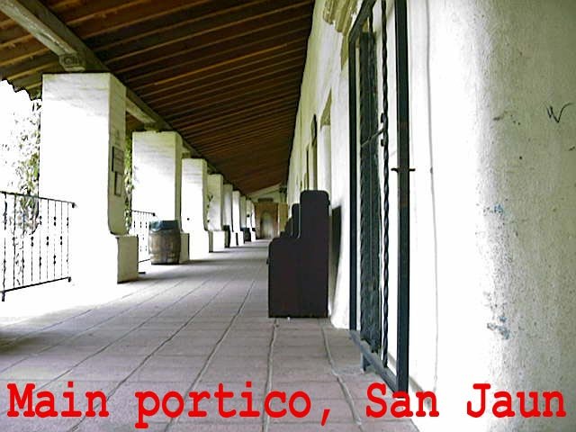
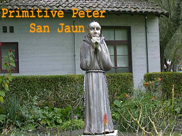
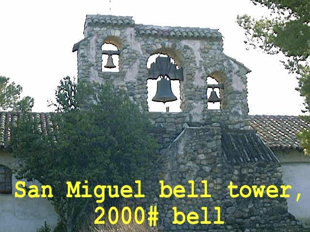
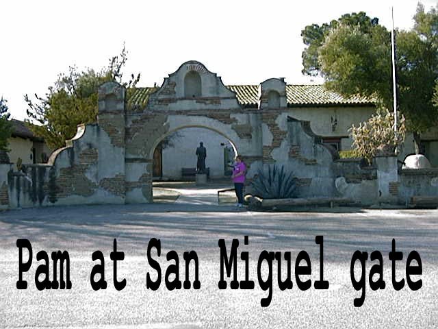
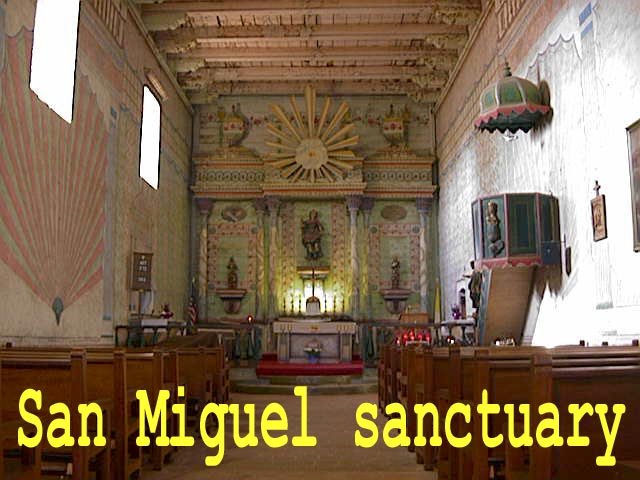
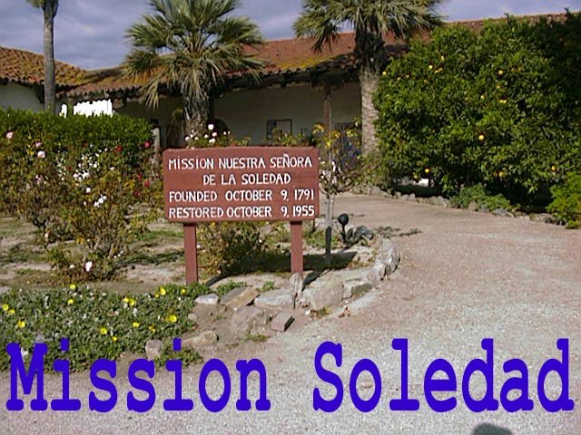
The Roman Catholic missions of the southwest are, I believe, one of the more misunderstood parts of the area's history. We tend to think of them as a religious organization, but they are much more than that. They play a major part in the history of this area that is significant to this day.

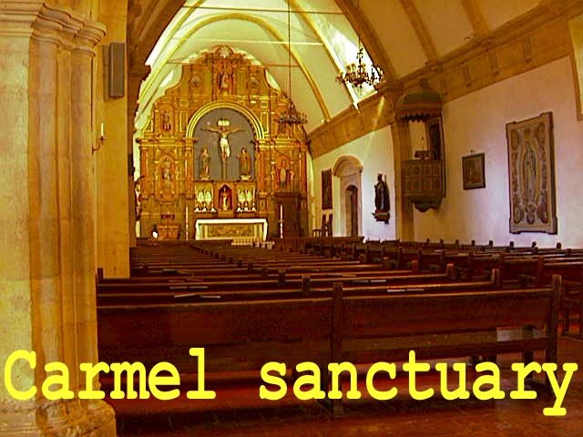
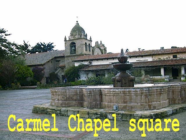
While England and the other European countries strove to settle the east coast of North America by bringing over citizens to colonize the area, and to push the local natives out, Spain took a very different approach in the southwest area of the USA and Mexico. Spain sent their military to subdue the natives and helped the church to send missionaries to control them by converting them to Catholicism and by instilling in those natives the cultural ways and language of Spain. They were remarkably successful in that effort.

We think of the missions as working with Indians, but there were really no Indians at all in the new world. The natives were called that only because of the incorrect belief that the first explorers had thought that they were in India. The people here, and in all of North America were in fact the Native Americans. Those converts of the padres were the ancestors of the Mexican people and or the people that we Anglos think of as Mexican who were living in Texas, New Mexico, California and Mexico.
By its actions in the new world, the Spanish government and the padres they brought here, unified a country and created an ethnic group from different tribes of natives, just as varied as the tribes spread across the parts of North America which were settled by the English speaking people. What developed was a mixture of the culture of the native people and of the teachings of the padres and is what we know today as the Mexican culture. Spain allowed the natives to flourish with this new culture and so set into motion the forces that led to the Mexican revolution, and thus were no more successful in the control of their new territory than was England.
Thus these people of Mexican heritage are the descendants of the same natives sought by the padres, and their roots go much farther back into American history than do most of ours.


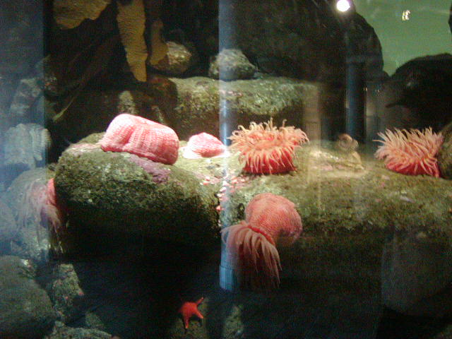
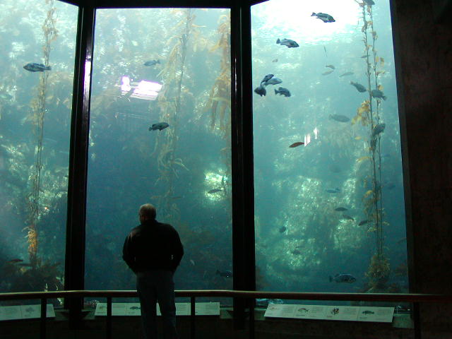
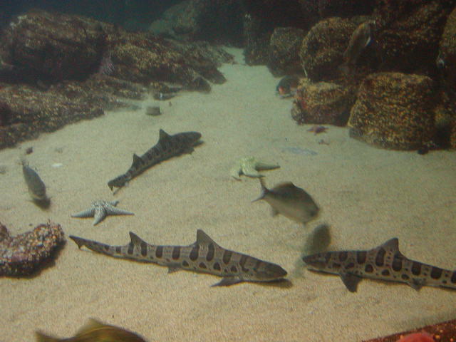
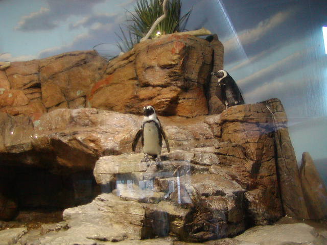
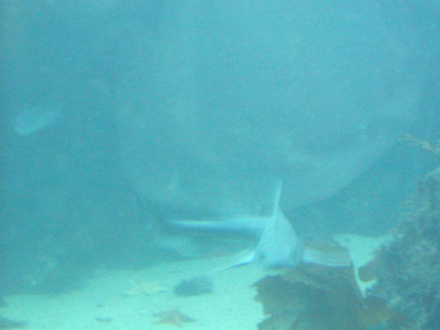
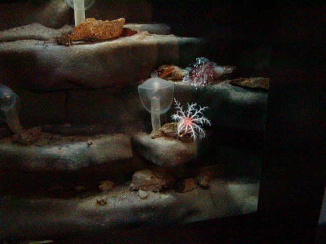
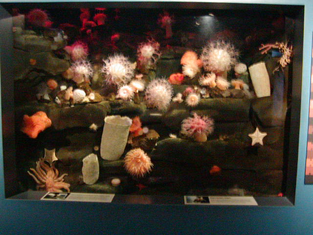
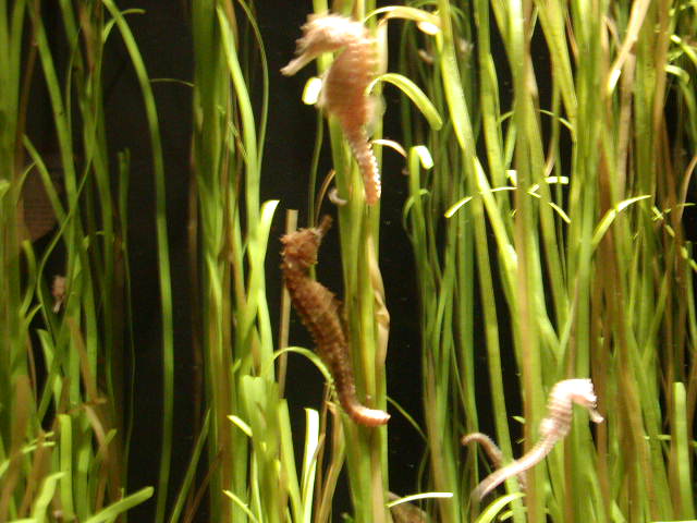
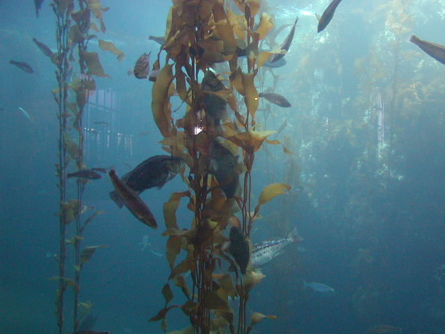
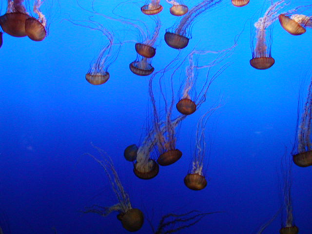
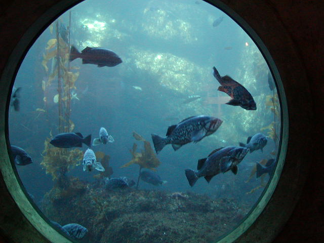
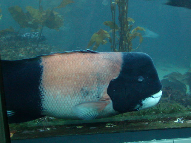
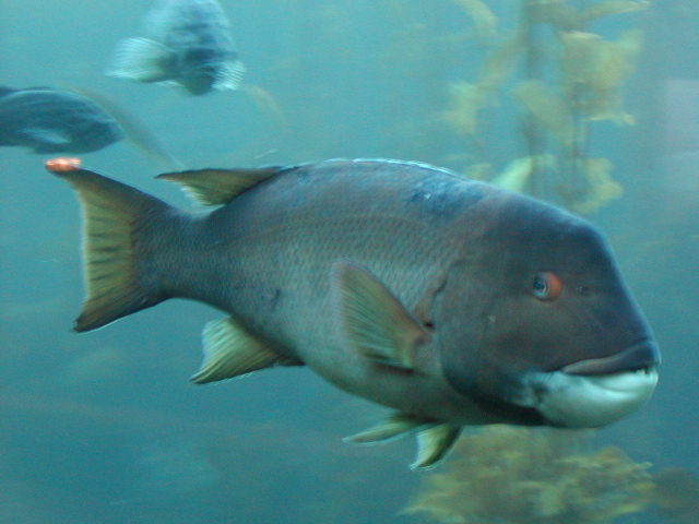
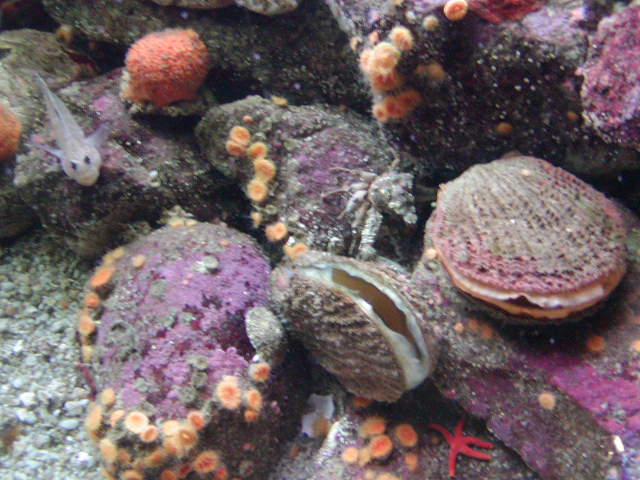
The Monterey County Parks Department was kind enough to sponsor a free trip to the aquarium for all of their volunteers in the county’s parks. We spent about three and a half hours in viewing one of the world’s greatest aquariums. These are some pictures from that visit. I hope you enjoy them.


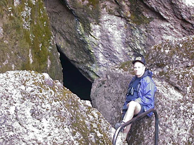
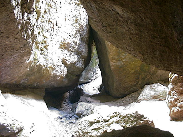
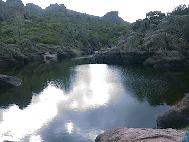
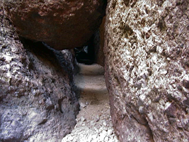
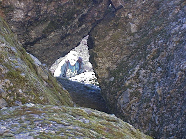
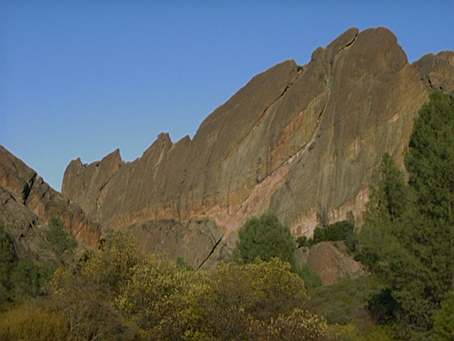
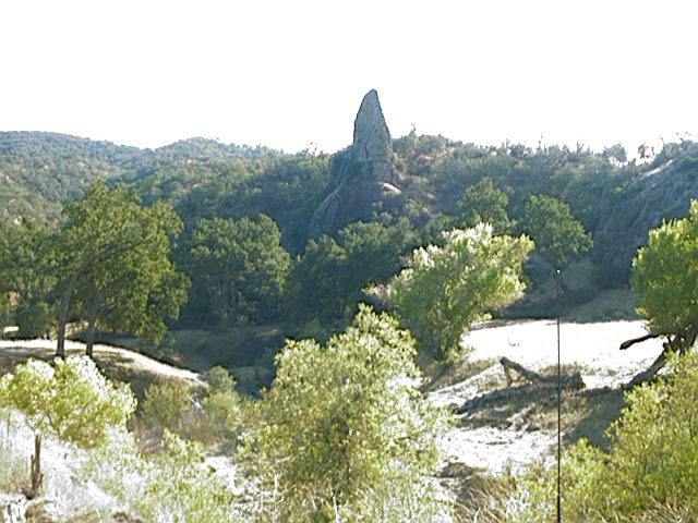
Pinnacles National Monument is one of those little visited sights that is not well known, but it is well worth your time! There are two entrances, one from the west and one from the east. It is about three miles by hiking trail between them and there is not a road between them, through the park. The most unique features of this park are two canyons, one at each side, which are a series of caves that were created when an earthquake dropped rocks larger than houses into the two narrow canyons. The canyons are so narrow that the boulders were stuck between the walls of the canyons before they reached the bottom. To see the best sights at either entrance you must hike for at least one half mile. The west side entrance is not a good road for RV travel, and the only camping at either park is a tent area in the west side of the park. The best place to camp while visiting either side of the park is at a Monterey County park in King City. The name of the park is San Lorenzo Park, and it has an excellent museum and very nice camp ground.
(Click on each thumbnail to see a larger version.)